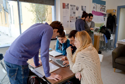
Via Abbiati is a border, one of the gateways to the San Siro neighbourhood. A few metres beyond, at the junction with Via Dolci, the tramway tracks of line 16 run like a scar separating San Siro’s colossal public housing blocks from the elegant private houses on the other side, now highly valued by the property market. Framed by colourful roller shutters, the windows of the 30Metriquadri space directly overlook the pavement. In what was once a bar that had stood empty for years, researchers from the Milan Polytechnic have set up their headquarters overlooking the area on which the Mapping San Siro research project is based.

I. A permanent laboratory
The Mapping group studies the physical, urban and architectural spaces and the social and political element that pervades the lives of the neighbourhood's inhabitants.
Mapping San Siro was founded in 2013 as a workshop. The idea first came from Francesca Cognetti and Beatrice De Carli, professors from the Department of Architecture and Urban Studies at the Milan Polytechnic who wanted to begin an initial exploration of the neighbourhood in the form of field research, using a classroom in the Cadorna school as a base. This research interweaves various topics and methodologies together: the study of the physical, urban and architectural spaces and the social and political element that pervades the lives of the neighbourhood’s inhabitants. The number of participants exceeded expectations. A few months after the project was launched, students and researchers from other universities also came forward. “When it was over, we felt we still had so many questions,” exclaims Alice Ranzini, graduate in urban planning at the Polytechnic, “So that’s why we decided to continue and investigate other areas.” This decision constituted a new chapter in the Mapping story; finding a permanent place to settle became the next area of focus for the group, which would allow them to continue their research. In the meantime, the group survived on temporary solutions, taking advantage of the help and generosity that was offered to them by certain associations in the neighbourhood, who lent them a space and chairs.
For the Polytechnic, this project, which involves deploying a group of professors and students in the field, responds to the idea of combining teaching and fieldwork with a shared planning process. In technical terms, this kind of work method is known as ‘action research’. According to this model, urban space is a product of society, a place where every single player present in the area participates in the construction and change of the surrounding context. The Mapping group’s research revolves around three main axes:
- The home and habitation
- The building and communal areas
- Business and social areas which remain unoccupied and unused
Specifically, housing deprivation and population composition are the main topics of focus for the group’s investigation. The researchers have taken an X-ray of the San Siro neighbourhood, breaking it down into layers and then aligning this with institutional data, information collected in first person and residents’ statements. In 2013, this research activity concluded in an Istant Report , packed with maps, stories, reflections and suggestions.
Ingrandisci

II. Research results
8% of housing does not meet the criteria to be included on the public residential housing list.
The most pressing issue in San Siro is housing deprivation. Mapping’s researchers have carried out a census on the size of properties, which were often found to be overcrowded. 8% of homes do not meet the criteria to be included on the public residential housing list, as they are smaller than 28 m2. This equates to 270 homes below the threshold which cannot be assigned and are therefore in risk of being illegally occupied. Even flats that are deemed officially adequate are rather tight: 7% of all housing measures between 28 and 35 m2, whilst 68% of one-bedroom flats are between 35 and 45 m2. These properties are obviously not the best solutions for large families with adult children.
Housing deprivation in San Siro has also worsened as a result of the gradual loss of public residential housing assets: 1,459 homes have been sold over time and now, a new sales plan has been put into effect by Aler (which plans to sell 10,000 homes in Milan). Most of these houses have become privately owned or managed as part of public housing rentals by agents from the tertiary sector or special categories (to law enforcement agents or to staff of Milan’s transport company). A factor which stood out in their findings was that dwellings registered on the public housing list were rarely located within the same building and instead were spread around different parts of the neighbourhood. Despite their attractive prices compared with other areas of the city, many of these properties do not find buyers and this contributes to the feeling of abandonment in the area.
In order to analyse the complex issue of unoccupied houses, researchers have collected official data from the housing owner (Aler), the tenant union Sicet, the Milan city hall ‘Laboratorio di Quartiere’ (the association which manages aspects of the neighbourhood renewal programme) and statements taken directly from residents themselves. At the end of 2012, there were 780 vacant houses in the neighbourhood and 7,000 in the rest of the city. This is a staggering figure, especially when compared with the 21,000 requests for housing and considering that Milan city hall assigns around one thousand homes each year.
40% of residents in San Siro are immigrants. This is a considerably higher average compared to other neighbourhoods in Milan (19.5%).
Tracking down the unoccupied properties in the area required patience. The results have been used to create a detailed map of the blocks where these vacant flats are located. Parallel investigations carried out in the neighbourhood revealed a general malaise and stories of illicit squatting were cited as just one of the many ways of gaining access to a house in San Siro. Although access to a property can be gained through buying or renting (if registered on the public housing list or in special categories), there is still room for illicit practices such as squatting (which may also have an organised support network) and subletting arranged by Aler tenants.
The origins of the 11,000 people who live in San Siroare also somewhat diverse. 40% are foreigners, which is a high percentage relative to the 19.5% average for Milan, and predominantly hail from North Africa, (Egypt, Morocco), as well as Yemen, Peru, the Philippines and Romania. The Report compiled by Mapping not only drew up a list of foreign countries with the most residents in the neighbourhood, but also included data such as the level of education and the working and family situations of residents. The overall picture is a cultural mosaic which constitutes both an enrichment and challenge for San Siro.

III. The 30Metriquadri model
Before moving to Via Abbiati, the Mapping group relied on the support from other active associations in the neighbourhood, a temporary solution contributed to building ties with the area. The group then received an offer from Aler to put them up in a former bar at 4 Via Abbiati, granting them free use of the space for one year. The Polytechnic covered expenses such as water, electricity and gas. It seemed like the perfect place to plan their work, gather information and receive guests.
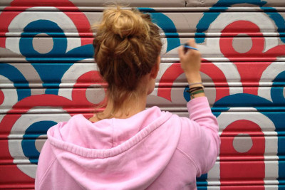
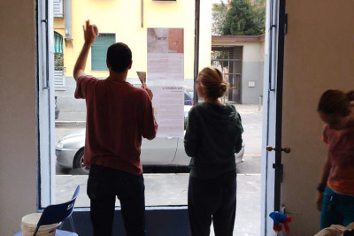
But there was still a lot more work left to do. Before setting up, the researchers plastered the walls, polished the floors and repaired the windows. Even the 30Metriquadri office is itself the result of teamwork. The name, which means ‘thirty square metres’, is both descriptive and a source of pride. Residents on Via Abbiati lent the group utensils, chairs, their time and a helping hand, whenever needed. As a finishing touch, the insipid grey of the doorway was transformed into colourful designs to welcome in the entire neighbourhood. The last bit of work was made to the external corner of the property. This area had become a sort of community dumping ground and so was cleaned and decorated with three large planters which had been discarded by Expo Gate. Neighbours not only appreciated this gesture, but also felt the need to contribute by adding their own plants and sharing their gardening know-how.
<br /> 30Metriquadri is an outpost of scientific research, another of the Polytechnic's premises, like the Piola and Lambrate campus.
Setting up shop in a problem neighbourhood like San Siro requires a substantial investment of time and the mediation of some of the more active associations in the neighbourhood, such as Alfabeti, the Italian-language school for foreigners run by a group of 40 volunteers, and Cooperativa Tuttinsieme, which has been promoting integration since 1992 by offering social, healthcare and educational services. “It was vital that we worked with people who already had an in-depth understanding of the neighbourhood,” explains Elena Maranghi. “It’s also thanks to them that our space quite quickly became a place for sharing a multitude of positive experiences.
“Officially, the 30Metriquadri space is part of the university campus,” adds Alice Ranzini. “The Polytechnic decided to include the San Siro campus with the Piola and Lambrate campus.” This outpost of scientific research, which overlooks the pavement of Via Abbiati, is often likened to an aquarium: behind its large windows, the life of this layered neighbourhood flows by, each of its layers representing topics for independent reflection, and Mapping forms an integral part of this ecosystem.
Researchers are divided into groups and move about independently. A meeting is held every Thursday to update colleagues and check up on progress. “An important part of our work is interviewing residents in the neighbourhood or individuals that represent associations based in the area. We carry out this activity here, in our space,” explains Elena Maranghi, Doctor of Research in Urban Studies at the Sapienza University in Rome. “We do inspections to check that the data we collect is accurate, and we meet people out and about in the neighbourhood.” Tasks that also fall under the responsibility of Mapping’s researchers include organising and running open events for the neighbourhood and city, as well as maintaining the 30Metriquadri office and of course, providing guidance to students on placements.
To self-finance part of the research, which is currently only sustained through voluntary work, the group has developed projects in partnership with other initiatives in the neighbourhood, applying for grants and winning the Educator Grant 2014: an award promoted by the Adobe Foundation which is aimed at action-research projects.


In 2014, the Mapping group won the Adobe Foundations' research award, the Educator Grant, which is aimed at action-research projects.
At the 30Metriquadri office, San Siro residents always find someone willing to lend an ear. “You can never be fully relaxed,” complains one lady, “The other night I was woken by noises, I thought people had got into the flat above me.” San Siro certainly has its problems, but it does help knowing that at 4 Via Abbiati there is a place where these can be shared. Nevertheless, from the start, researchers intended to involve as many people as possible in Mapping’s initiatives: workshops, meetings and open debates for everyone to talk about the topic of housing and everyday crises, not only from an academic standpoint.
Researchers from the Mapping team come from a variety of educational backgrounds: third-year students on their first placement, graduates who have chosen to continue participating in the project after graduating, doctoral students, research associates, experts in town planning, sociologists and architects. The group is led by researcher Francesca Cognetti from the Department of Architecture and Urban Studies at the Polytechnic and Ida Castelnuovoprofessor of Territorial Planning and Public Politics at the Iuav University of Venice and project manager for the Fondazione Polisocial an academic social responsibility programme run by the Milan Polytechnic.
Giovanni Tanca has worked on the project since October and is due to finish his degree in Urban Planning. He joined “because San Siro is one of the largest public housing areas in Milan.” Alice has chosen to continue collaborating with the Mapping group even after graduating. She works part-time and dedicates all her remaining time to the project.
“I joined the team when I was still finishing my PhD,” explains Gabriele Solazzi. “Afterwards, I decided to stay on as I saw it as a unique way of doing fieldwork, far from dusty libraries.” Elena Maranghi moved to Milan to write her doctoral thesis. She met the Mapping group at the 2013 workshop, when she first heard about this working-class neighbourhood, which was very different to what she had imagined as a student coming from the Sapienza University in Rome. “All those attending the workshop that had come up from Rome, like me, did not consider it a real suburb,” she explains. “In Rome, suburbs are far away and disconnected from the city, which basically don’t form part of the urban fabric. Of course, this doesn’t mean that they don’t have their problems, it’s just that you can’t see them at a first glance. As a neighbourhood, San Siro has huge potential. The fact that it is located fairly centrally means that residents have access to many services that don’t exist elsewhere.”
Gradually, the neighbourhood’s residents have come to see 30Metriquadri as part of San Siro. By peering through the large transparent windows from the pavement, residents have cultivated the spirit of the project and have begun to collaborate. Occasional meetings have turned into routine visits, and it is these perpetual comings and goings that have enabled researchers to directly interact with the object of their research. “If you plant rosemary in the planters, make sure you take off the flowers, they take all the nutrients away,” chimes in a lady passing by, carrying a shopping bag. She then stops to have a chat with one of the researchers. From plants, the conversation turns to childhood memories.


