
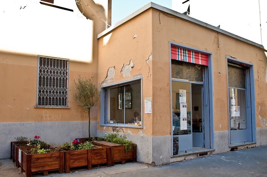
The Mapping San Siro office is furnished with what little the group of researchers need to work: two tables, a few chairs, a shelf with leaflets and notes about the neighbourhood and plenty of instant coffee ready for people that drop in. These days in Milan, all anyone talks about is house squatting, with evictions, protests and clashes between the police and community centres acting as a backdrop. Nevertheless, at 4 Via Abbiati, where the Polytechnic has quietly and discreetly set up shop in an old converted bar allocated by Aler (Milan’s public housing company), the pulse of daily events has its own rhythm. Residents follow the news with a mixture of curiosity and annoyance, knowing fine well that what makes the news today will fall off the radar of the newspapers in a few months’ time.
People are made of stories, not atoms.
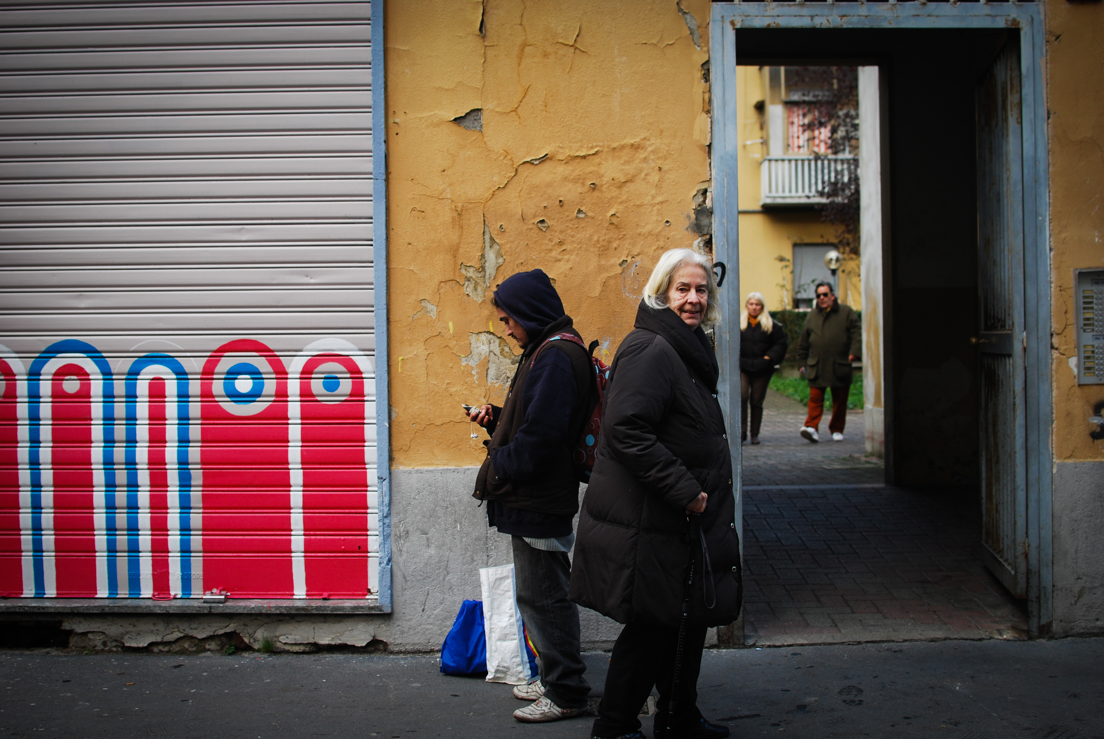
Treading carefully, the researchers from Mapping ventured into this ticking time bomb in early 2013, eventually winning over the neighbourhood’s trust. Over time, they have gradually come to form part of this social and urban fabric, which is taut with all manner of tensions, drawn in by their suspicion that beneath the surface of the crisis lay the real news. The group is mainly focused on housing topics and the prospects for Milan’s public housing assets. But not exclusively. Their observation point has a direct view over the street, or rather, the pavement. Trentametriquadri (meaning ‘Thirty square metres’) is a room with two windows, where passers-by are invited to come in and tell their story, or simply to have a chat. “You can’t describe all this with just one interview,” says project coordinator Francesca Cognetti, gingerly, San Siro is not just one of Milan’s problem neighbourhoods, rather it represents a complex reality, a social lab that can help us understand where we’re going. Describing just one aspect of this would be limiting. Multiple perspectives need to be heard. That’s why we’re here.”

I. Researchers on the street
Francesca Cognetti works in town planning and public housing. It was her idea for the Polytechnic to set up in the neighbourhood and to inspire the research group by bringing in Liliana Padovani : professor of Urban and Territorial Politics at the University Iuav of Venice. After one year’s observation, they were able to paint a fairly accurate picture of San Siro’s identity, which they have summarised rather dryly as: a place where too many different situations coexist for it to be limited to the restrictive contrasts between regular residents and illegal residents, or between good and evil.
The Mapping project was created with the intention of developing ‘participatory research’ activities together with individuals involved in the neighbourhood. Talking with people is exactly how Francesca and Liliana were able to construct a second map for San Siro, which at a first glance appears to be invisible: this one features the networks and links that make up the neighbourhood’s social fabric, which replace public administration when it fails to take action.
In the various areas that make up San Siro, practices are emerging as a result of the difficult housing situation, different people living together and lifestyle adaptation.
These practices interact with particular settings in the neighbourhood: the courts, the home, communal areas, public-service companies and businesses. The result is both a complex system of places that are tied to their societal use and a geography of abandonment and conflict, which strive to conform to a system of government regulations.
Even Francesca lives in San Siro. Or rather, she lives beyond Piazzale Brescia, the line that separates the working-class zone from the residential one. “My house is right on the imaginary border between these two worlds,” she explains. “I’ve always felt a strong attraction towards this area. But the opportunity for me to visit the Quadrilatero, our name for the area of working-class houses between Via Ricciarelli and Via Paravia, really came when I decided to enrol my daughter Lisa into one of the schools in the neighbourhood. It was thought of as a troubled school with a high number of foreign students, and certainly a meeting point between Milan’s two souls, the city of the poor and the city of the rich. This decision has opened a window onto San Siro for me.”
People are made of stories, not atoms.
Her daughter’s school has enabled Francesca to immerse herself in the human and social fabric of the neighbourhood: “They were no longer just ‘foreigners’, ‘residents of public housing’, or the people that had only concerned me during my studies, but were suddenly my daughter’s classmates and their parents. It was like discovering a world that had always been there, within arm’s reach, yet one that I had never really noticed.” Curiosity and the countless situations of great suffering that Francesca encountered eventually led her through the gateway of Via Maratta and Via Ricciarelli, all the way to Via Abbiati. The birthday parties of children from school gave her chance to go inside these homes and talk to the people that lived there.
“It got to a point when I realised I was looking for any kind of excuse to pass through the neighbourhood, be it to run an errand or to take the kids somewhere.” Soon curiosity turned into scientific interest, and San Siro began to form part of Francesca’s academic work, which captured the interest of some of her students, who ended up working with her on the first final dissertations on housing.
Ingrandisci
“The first real step,” continues Francesca Cognetti, “was in March 2013 with the action-research workshop, , which was organised together with Beatrice de Carli and promoted by the School of Architecture and Society and the Department of Architecture and Urban Studies of the Milan Polytechnic. The idea was to study San Siro in order to create a sort of ‘participatory mapping’ that would identified key areas and the social and institutional connections that exist in the neighbourhood.” It only took a few days for the research group to gather together an unexpectedly large amount of material. “At that point we decided that we couldn’t just stop there. We wanted to establish Mapping as a proper research group.”
But why does San Siro need a map? Redrawing the neighbourhood’s borders, places and areas is certainly no easy task. The method that the Mapping group uses when studying the urban fabric around them is indeed complex.


“See this map?” Francesca asks, pointing to a map of the Quadrilatero, “This is the neighbourhood that was actually planned, but it does not tell the whole story. This is just a map that shows street names, so it can be used to identify the blocks made up of Aler’s public housing. But this piece of paper is utterly incapable of telling us anything about the social situations of people that populate these streets and buildings. Our aim is to put this world on the map, as it would otherwise continue to be ill-defined and have no identity of its own.”
Mapping carries out what academics call action research, a research method that emerged from the coming together of researchers and individuals based in the area which aims to devise solutions to problems associated with liveability, integration and social segregation. Francesca explains: “I became aware of this tool thanks to meeting with a group of researchers from UCL in London, who were mapping informal settlements, shanty towns, in the Global South.”
Although public housing is not like a favela, these two worlds, which at a first glance appear to be poles apart, do in fact share similar levels of informality in their relationships and circumstances. On the one hand, it is a city that is growing without a set urban identity; on the other, it is a rational plan of area management, which, in absence of a coherent and consistent public intervention, internally develops autonomous situations in search of some sort of legitimisation. “The map of San Siro is a grid of streets, squares, courtyards and buildings. But it doesn’t describe the social relationships or the connections between the different areas that have formed in the neighbourhood. We want to draw a new map that represents what San Siro is like today.”
II. What has become of the model neighbourhood?
The town plan of San Siro appears to have been designed according to geometric rules (hence the Quadrilatero), with a grid of streets running through it. “Residential buildings are arranged along what is known as the “heat axis” so as to get the best possible exposure to the sun,” explains Liliana Padovani.
At the end of the 1940s, when construction work was complete, the neighbourhood was set in an entirely different context to now. Housing was located virtually right next to the open countryside. It was only with time that San Siro was absorbed by the rest of the city. It is now a suburb that lies relatively close to the centre and is located just a few blocks away from the residential areas of De Angeli and CityLife (formerly Fiera), on the edge of the ring road.
“Despite being built during the war with poor material,” continues professor Padovani, “the neighbourhood wanted to become a sort of city of the future, a model example for all others. Basic flats were trialled inside these buildings, which were very small, but respectable, and featured kitchenettes and bathrooms inside the home itself for the first time.”
“Not long after we opened our laboratory on Via Abbiati, a well-dressed lady and gentleman walked in. They had recently been evicted from a house in the centre and admitted that they really appreciated the comfort of a small, well-designed apartment.” It is shame though that this very innovative experiment did not stand up to the facts.
Evidence suggests that from the 1940s onwards until the present day, in many parts of the neighbourhood, not a single maintenance operation was carried out. This can be seen even from the street, where building façades appear to be on the verge of tumbling down: plaster is coming off the walls and there are cracks and windows without glass. Both the town planners are in full agreement as to the reasons behind such a state of abandonment: public housing in Italy has always been thought of as second-class. “In other countries, public housing is not only intended for the most needy section of society. In Switzerland, many public servants, like university professors, live in buildings that belong to the state,” explains Francesca. “They have a different kind of approach abroad, and governments continue to invest in public housing.” The consequences of this are clear to see: in Europe, the percentage of state-owned houses is considerably high, between 15% and 18%, whilst in Italy, it is only 4%. Since the 1990s, there have barely been any new buildings in Italy.


Another problem unique to Italy is the lack of a buffer zone between public and private housing. In a city like Milan, those that no longer want to live in public housing have to deal with paying rent. This would mean, in the best case scenario, going from 200 to 1000 euros a month, as rent regulation and social housing are practically non-existent. “The direct consequence of the lack of housing policy that would divide the offering up into its various components (private, social housing, public sector), as a repercussion, results in there being absolutely no spare places available in public housing, whilst the concept of a public home being temporary accommodation, or one that has a lifespan depending on how long it is needed, no longer applies. This is partly because many people cannot afford to pay five times as much to rent an apartment, and partly because the necessary regulations are not in place: neither income brackets nor household structures are regularly reviewed.
People are made of stories, not atoms.
This deadlock would explain the 20,000 applications that are awaiting assignation against the total 75,000 homes in the city. Clearing times for the list are somewhat discouraging: every year, around 3,000 apartments free up, but a significant portion of these are assigned to emergencies, namely to people who, despite not being on the housing list, are entitled to a house because they have been on the end of an eviction order. This is how the phenomenon of squatters and illegal residents begins, who are often blamed for all the problems.
Last November, the Mayor Pisapia wanted to signal change by stopping the collaboration with Aler and entrusting municipal public housing management to the Metropolitana Milanese company. “It was a bold decision,” says Francesca, “but will have negative repercussions.” The researchers fear that the cost of transferring this ownership will be borne by San Siro. as a matter of fact, the entire neighbourhood is owned by Aler and this is why it will not fall under MM’s new management. “We fear that this will become the pretext for the town hall to be able to wash its hands of San Siro.”
The already crumbling Quadrilatero will remain in the hands of those who are generally believed to be responsible for the poor management of Milan’s public housing: Aler (The Residential Housing Company of Lombardy). This regional entity was created to replace the Public Housing Institute and has been in charge of the management and requalification of Milan’s public housing since 1996. For three years, Aler has experienced a disastrous financial situation as a result of a particular approach to asset management that does not prioritise enhancement, and of decisions that paid little heed to the social or financial sustainability of operations. Aler has accumulated a debt of €306 million and is on the brink of bankruptcy.
Trapped in this kind of reasoning, San Siro remains a neighbourhood where widespread anger merges with concrete efforts to overcome hardship and marginality. In the meantime, Mapping has become a point of reference. From those humble thirty square metres overlooking the street, town planners are getting hands-on in the field, mapping out new social interactions.